British Columbia
Sunday morning I peer out of the hotel window and I'm frowning. The weather outside isn't so great as it's raining. Most of the mountains are covered in clouds and there are puddles of water in the courtyard. I check my phone and the weather report today is rain in both Alberta and British Columbia. I sit on the bed and my girlfriend asks me what's wrong. I tell her it's raining and driving on the Bow Valley Parkway is not going to happen. Perfect weather can be hard to come by when on vacation, especially in the mountains. We head down for breakfast and I stuff my face with eggs, bacon and home fries to feed my depressed state. To wash down the misery, I have about 4 cups of coffee. Because today, we're heading to BC to see my mom and sister. We'll be there for four days and then return to Alberta to spend the rest of the time in Banff before flying back to Ohio Saturday. After breakfast, we wake the kids and tell them we're hitting the road.
We check out and head out towards the Trans Canada highway. Before heading out, the kids want coffee. I take them Tim Horton's which I tell them is the Canadian version of Dunkin Donuts. Tim Hortons is practically in every town somewhere in Canada. Canadians do love their coffee as they consume more than any other nation. I verse them by telling them if you want double cream and double sugar, you say "double double" and the person behind the counter will understand what you want. When I moved to the states twenty years ago, I really missed my morning cups of Timmy. Whenever I went to Ontario, I would bring back bags of it as I was never really into Starbucks or Dunkins. To add to the junk food collection in the back, we get some donuts. We buckle in and I punch in my mom's address. It's 230 miles and will take 5 hours without stopping. We hit the Trans Canada highway and the rain is coming down and the skies are grey. I joked that we brought Cleveland weather with us. To add insult to injury the weather back home is currently sunny and hot.
Traffic is light for a Sunday morning. Alberta has built a beautiful highway that can handle traffic at high speeds through the mountain passes. Along the highway, there's a fence that prevents wildlife from being killed by traffic. I couldn't imagine the number of animals dying before the fences were erected. They go for quite a distance and there's a couple of bridges that the animals can use to cross over. From what I read, it's been a success as many species of animals have utilized it. The kids are in the back watching movies or playing games. I told them that cell service will probably be nonexistent so they needed to download it the night before. The drive for the most part through Banff is uneventful. The Bow River, however, looks beautiful as the deep blue-green hues of the water stand out. The divided highway comes to an end that means we're at the border of Alberta and BC. We leave Banff and enter Yoho National Park. Yoho in Cree means "in awe and wonder". If it wasn't for the low clouds we would probably be in awe of the scenery.
Yoho National Park is the smallest of four contiguous national parks. Yoho along with Banff, Jasper, Kootenay and three provincial park form the Canadian Rocky Mountain Parks World Heritage site. The parks encompass an area about 2,299,104 ha in size. These parks have a long history as most were established well over a 100 years ago. Due to time constraints, Yoho would only be viewed from the car. If the weather was better, I wanted to stop off at the spirals as Kim's son would enjoy watching a train go into the bottom of the mountain and come out at the top of it, while the back end of it was still going through. I mentioned it to him if the weather was better, we would stop on the way back.
The rain continues as we leave Yoho and head towards the city of Golden. There's one stretch of the Trans Canada highway that gets a bad reputation and that's the section of highway leading into the Kicking Horse Canyon. The highway hugs along the mountains and has hairpins and tight curves. I see the brake check ahead that is for truckers. The rain has stopped for the time being and we can see the tops of the mountains. We enter what the locals call "ten mile hill" because you're going downhill for ten miles. As we pass the brake check, we enter see two huge rock columns on both sides of the highway announcing your entering the canyon. That section of the mountain was blasted away so engineers could erect a bridge across the Kicking Horse River. So why the name Kicking Horse? It isn't named after an Indian chief, but after an incident that happened in 1858 when James Hector, a surgeon, and geologist to the Passiler Expedition. According to his journals, one of his pack horses fell into the river and panicked. When he tried to grab the horse, it kicked him in the chest, almost killing him.
After the bridge, the road straightens out until the divided highway ends. I pass a large truck just before the road goes to a single lane. The road is tight when I hit the first curve as I grunt turning the steering wheel. There are large cement blocks along the road that prevent mudslides from crashing onto the highway. Farther up, there's are a series of rock curtains. The curtains protect motorists from falling debris. The road is really tight and there's no margin for error. I can't imagine doing this in the winter or driving a large truck through this. I watch a couple tour buses go by and there's not much room to spare. I remember my mom telling me once a mudslide happened and the highway was shut down for five hours. During the summer months, traffic through here will often back up as large trucks, RVs and vehicles hauling campers struggle to make their way up and down. No wonder my mother prefers to fly to Calgary instead of making this drive. We make it through the last curve and the highway divides all the way into Golden where we fill up for gas and stretch our legs.
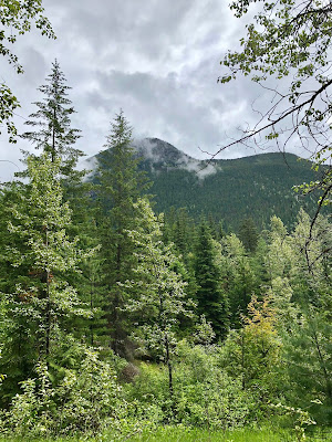
Another coffee, more donuts and we continue on. The Rockies are far behind and as we enter Glacier National Park. The mountains here are named the Selkirks and are part of the Columbian range. Glacier is the 2nd oldest national park in Canada as it was created in 1886. The park is 521 sq mile in size, slightly larger than Yoho. Clouds obscure the mountains, but we see the large swaths of openings between the stands of trees. Glacier gets an abundance of snow and the area is prone to avalanches. That's evident when we enter Roger's Pass. This section of Glacier gets about 32 feet of snow during the winter. Several mountains are practically next to the highway and due to their steep nature, there are a series of snow sheds to protect motorists.
We see the sign for the Rogers Pass Discovery Center as we need to use the bathroom. We pull in and when I open the door, I immediately feel the cold. I could swear, that I even saw a couple snowflakes. Makes sense as we're about 4,360 ft above sea level. We all go in and when I leave the bathroom, I walk around as I'm waiting for the others. The center has several exhibits about the pass and the fauna of the park. There are several mounts of animals on display. At the center of the floor is a caribou mount. The description tells of their plight. Caribou populations in the Selkirks have dropped drastically over the past few decades. Today, they're barely hanging on and wildlife biologists have determined they'll become extinct very soon. Logging is the biggest culprit as caribou need old growth forest to survive. Younger forests attract moose and deer and that in turn attracts wolves. I remember seeing caribou along the Alaska highway north of Fort St. John 20 years ago when I lived in Northern Alberta. However, I've learned that population is also in trouble.
I look at the GPS and we're a couple hours away from Vernon. Unfortunately, we're stuck behind a large camper as cars and trucks start piling up behind us. Add a pounding headache from all of the sugar I had, I start to become annoyed as we're stuck behind him. Compared to Alberta's section of the Trans Canada highway, BC's is terribly outdated. Nearly all of it is single lane with a few divided sections thrown in. We finally hit a divided section and I floor it. I look over and it's an elderly couple and he looks stressed. I can't blame him as hauling a 25' camper and I'm sure driving down the Kicking Horse raised his heart level.
We stop outside of Revelstoke for another bathroom break. I lay off the coffee because I'll be using the bathroom every 45 minutes. The GPS tells me that in a few miles, we'll be getting off the Trans Canada highway and onto to highway 94A. We enter the town of Sicamous as I hear the kids snicker in the background as their mother announces the name of the town as sick-a-moose. We see the sign and it proclaims itself as the houseboat capital of Canada. The highway hugged along the shores of Shuswap Lake. As expected we see a lot of houseboats docked at several marinas. Gradually the mountains turned into foothills. It felt like an eternity as we've been on the road for hours. The kids are starting to get hungry and I tell them we're 30 minutes away. But, that doesn't fly as they want to eat now. Along the highway, we see signs for the Log Barn. Every few miles we would see another sign. It was almost like they were trying to entice us to stop in. We figured it was a restaurant. We see it and pull in, I start to chuckle because it's something I've never seen before. The place bordered on the absurd. We pull in and it's the most cheesy place I've ever seen. Silly dinosaur sculptures, goats playing on metal structures and statues. Thinking there was a restaurant inside, there wasn't one. It was a country store that sold meats and other products. I quickly went the bathroom and got everyone back in the car. The kids were really hungry and Armstrong didn't have a lot of options so we settled on McDonalds. The burgers and fries hit the spot and it was back on the road.
The final leg of the trip as I see the outskirts of Vernon. We cross over town and turn onto my mom's street. However, I only have the address of the park and not her unit. I call which happens right in front of her unit and I see my mother in the window waving. The long journey is finally over as I get out. My girlfriend Kim, meet her last year in Ontario when we spread my father's ashes. She introduces her children to her as I'm unloading the car. Her home is tiny but inviting. I'm expecting my hear my father bellowing deep from his man cave, but the house is silent. I feel a sense of sadness as my father passed away a little more than a year ago. The last time I saw him was in Niagara Falls in 2015. I made a lot of excuses not to come out because I was uncomfortable flying by myself. I still remember the day when they told me they were moving out west. I would have never imagined them ever moving, as their roots were so deep. But, they wanted to be near their grandchildren. That happened 12 years ago. His death made me realize that time is so precious and I was using my fear of flying as a reason not to go, in the hopes that they would come out and see me. I felt a sense of pride that I pushed my irrational fears aside and made the journey.
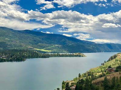
My mother's home is located right across the road from Okanagan Lake. Due to snowmelt from the surrounding mountains, there's hardly a beach as several willow trees are partly submerged about 100 yards into the lake. The hills along the lake are sparsely vegetated. The weather is cool, which is uncommon for this region of the province as temperatures routinely get into the upper 90s and even into the 100s.
Vernon is located in the Okanagan region of the province. The city is located at the north end of the lake. When we drove in, the first thing I noticed about the city was the lack of zoning laws. There were mobile parks right next to multi-million dollar homes or businesses right next to homes. The region attracts a lot of wealthy people from the west as it's a very popular destination for the summer as the lake provides plenty of room for boating and weather is often very hot and sunny. Due to the climate, the region has a thriving winery is often referred to as the Napa Valley of Canada. There's also plenty of orchards along the lake. The other thing that was noticeable was the number of homeless people. At several busy intersections, there were several erected structures that housed them. From what I told, Vernon has a huge homeless problem, considering it's not a big city.
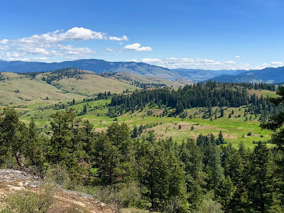
It's Monday morning and we're heading to Kalamalka Lake Provincial Park where my mom and her friends do their morning walks. The park is small when I look at the placard describing the features of it. One placard does draw my attention as it mentions rattlesnakes are numerous here. Fortunately, the weather is cool enough that we won't see any. We make the hike as the trail hugs along the lake and then gradually goes up. The park preserves one the last remaining shrub grasslands that once stretched from Vernon all the way down the U.S border. We stand on top of a cliff and view the lake and surrounding hills. The lake is peaceful which in another month will be full of boats and jet skis. The hike isn't very difficult and pretty short in duration. We head over to Davidson's orchards for lunch and the evening is spent with my sister's family going to the movies. During that time, I'm trying to figure out what to do for the kids. There isn't much to do in Vernon and I wrack my brain over it.
The weather isn't helping as temperatures barely make it into the 60s. It's far too cold for the kids to paddle board or swimming. Tuesday we go shopping in Lake Country and then head over to the Sparkling Hills resort. The resort is a world-renowned health and wellness retreat. My first impression of it was it bared a striking resemblance to a villain's headquarters seen a James Bond movie. Inside the place is decked out in crystals as the owner of the place is Gernot Langes-Swarovski, the Austrian crystal baron. The resort offers a lot of packages for people who have chronic ailments. My girlfriend who has a chronic illness is well versed in natural treatments is intrigued by some of them. We step out to the back and we get a great view of the lake. The three days there were spent mostly with family. We didn't get the opportunity to go to Kelowna or the surrounding area. I was hard pressed to find any activities for the kids to do.
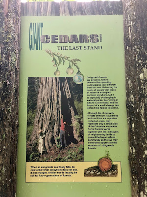
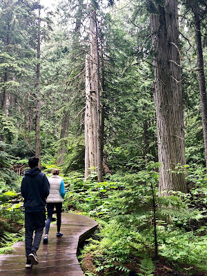
Time goes by very fast and it's Thursday morning as we're packing to head to Alberta. My mother was happy that we made the trip out and wished us a safe trip back. The weather heading out is deary and grey. The weather outlook for Banff isn't great either as they're calling for rain every day. But something happens when we reach Revelstoke as the clouds part and the sun comes out. I remember my brother-in-law mentioning that we should stop at the Giant Cedar grove off the highway in Mount Revelstoke National Park. We see the sign and pull off to stretch our legs and get some fresh air. We park and I hear the sounds of chainsaws in the distance. I see there's a manned park kiosk and walk over. The staff member tells they're doing work and we can still access the grove. Since we're in a national park, I can get a park pass for the days when we're at Banff. Park passes bought can be used in any national park in the country. The grove is located 30 km east of Revelstoke. The trail is a boardwalk and access is very easy. Part of the trail was closed off because of maintenance, but the scenery was amazing. Some of the trees in the grove are over 500 years old. Hard to believe that the grove is right off the highway because you stepped back in time, when much of this area was once virgin forest. I look at one tree and ask Kim to take a picture of me to show the true size of it. I stretch my arms out and they don't even touch the sides of it. Even though we couldn't do the entire boardwalk, I thought it was a hidden treasure to see such magnificent trees.
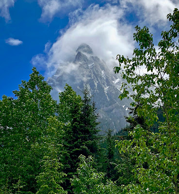
Heading back on the road and we're entering Glacier National Park once again. This time the clouds have parted and catch a glimpse of one the mountains next to the highway pass the park center. For the first time we could see the tops of them and they were stunning. They were so steep, almost cathedral-like in stature. Several people pulled off to take pictures. The tops of several mountains were completely covered in snow. If only we had time to explore this wonderful park, but we could stay for a few minutes. Back in the car and we enter the snow sheds, but construction was in full force as we had to stop several times. One treat was a couple mountain goats on the side of the road right next to one of the snow sheds. We continue on and we enter Golden and make our way through the Kicking Horse Canyon onto Yoho.
As I promised Kim's son, we stopped at the train spirals. The spirals are located right off the highway. The walk isn't far and there were several placards telling the history of the tunnels. The tunnels are an engineering feat. How the tunnels work is when an eastbound train leaving the town of Field climbs a moderate hill, goes through two short, straight tunnels on Mt. Stephen, under the Trans-Canada Highway, across the Kicking Horse River and into the Lower Spiral Tunnel in Mt. Ogden. It spirals to the left up inside the mountain for 891 meters and emerges 15 meters higher. The train then crosses back over the Kicking Horse River, under the highway a second time and into the 991 meter tunnel in Cathedral Mountain. The train spirals to the right, emerging 17 meters higher and continues to the top of Kicking Horse Pass. Unfortunately, there wasn't a train as we saw a maintenance crew driving along the tracks. I was told at least 25 trains make their way through here daily. It was already past 3:00 PM and haven't reached Alberta yet, so we afford time to linger around in the hopes a train comes by.
We see the welcome to Alberta sign and our adventure to Banff begins.
Subscribe to:
Posts (Atom)

